English
Hike & Workcation in East Tokushima
Kamikatsu #3

Featured in "HIKE! TOKUSHIMA," a booklet of some of the best hiking trails selected by the East Tokushima Tourism Authority, you don’t want to miss these wonderful trails in the mountainous town of Kamikatsu during your workcation!
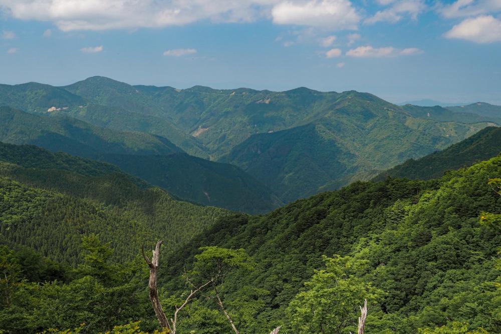
Nestle in the deepest mountainous area of the eastern Tokushima area, nearly 90% of Kamikatsu is mountains and forests.
Hidden in these deep mountains, the water sources of the crystal-clear rivers, the primeval forests of beeches and mosses have been carefully protected by the local villagers for hundreds of years and attract hikers from different regions to Kamikatsu.
Yoshigahira-no-iwaya and Todoroki-no-taki falls
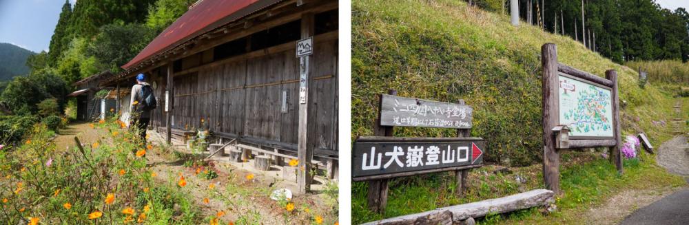
The gigantic rock cave of Yoshigahira-no-iwaya is an easily accessible trail from Tsuki-no-yado in the Tsukigadani Hotspring area where we stayed for our workcation in Kamikatsu.
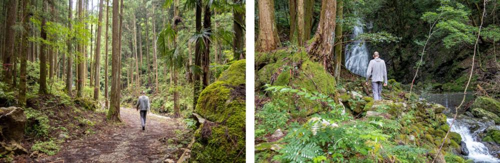
As it is less than 3 km along a narrow gently ascending road beside the Sugijidanigawa river, a tributary of the Katsuuragawa river, we headed to the cave by foot from our bungalow.
The Sugijidanigawa river is more like a ravine stream with countless rocks of various sizes scattered all around. In the fall, the trees along the river provide a brilliant red and yellow backdrop to the stream flowing through the rocks.
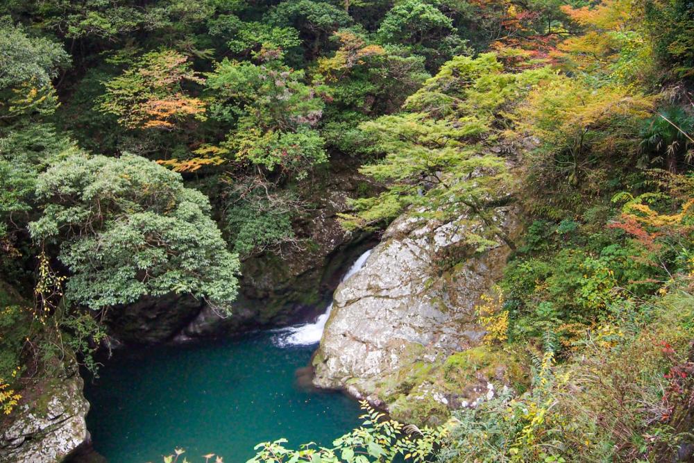
Heading upstream, we passed a deep blue pool in the river called Amadomari-fuchi. Surrounded by thick trees, dimly lit and mysterious, the turquoise green pool is said to be where a giant snake once hid itself in the water.
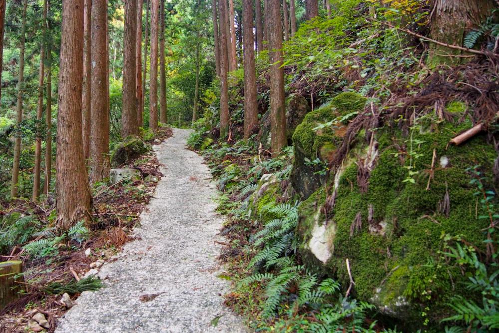
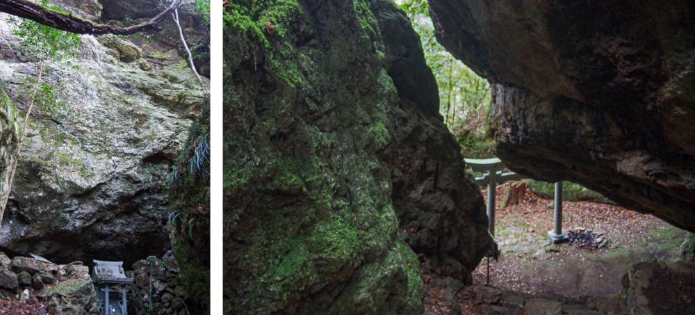
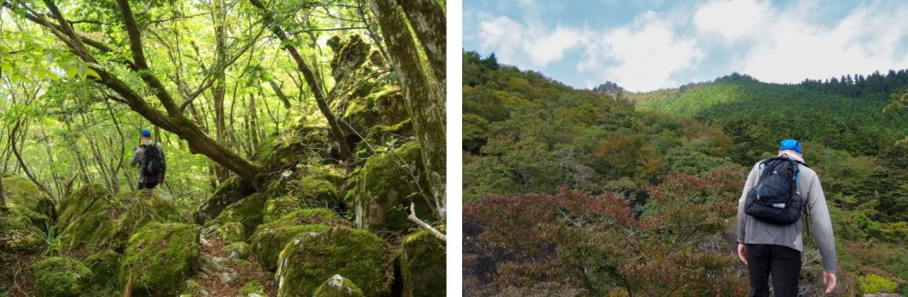
At the sign indicating Yoshigahira-no-iwaya cave by the asphalt forest road, we entered the path leading into the Japanese cedar forest.
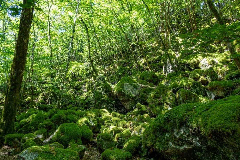
At the end of the grove of cedars, we arrived at a mysterious space in an untouched old-growth forest with huge rough shaped rocks covered with green mosses lying all around.
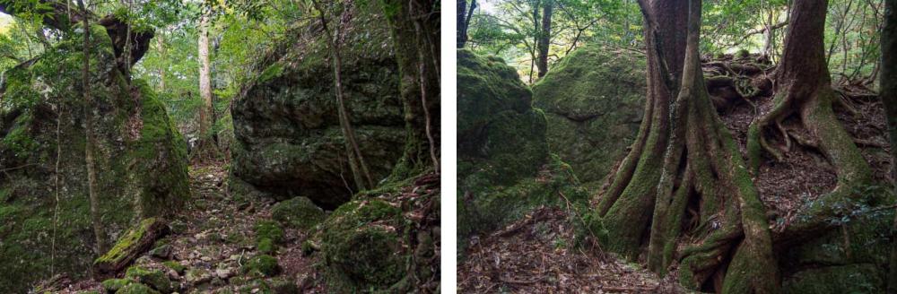
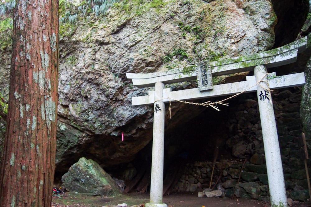
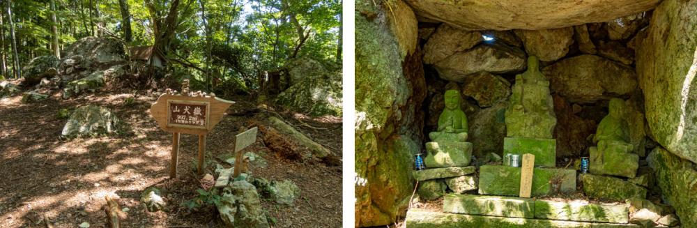
Yoshigahira-no-iwaya cave was formed with gigantic rocks and a stone Torii gate stood in front of its mouth.
There is an interesting legend about this cave.
Nearly 450 years ago, a female peddler from the village that is now the town of Mugi in the coastal area of Tokushima, was heading in the mountains to Kamikatsu to sell marine products but was trapped here by unexpectedly heavy snow.
The mysterious tale goes that a bear saved her after five days stuck in the cave, starved, cold, and almost collapsing. The kind bear warmed her up in its furry arms and gave her honey.
A tiny shrine is enshrined today at the place where the kind bear saved the peddler.
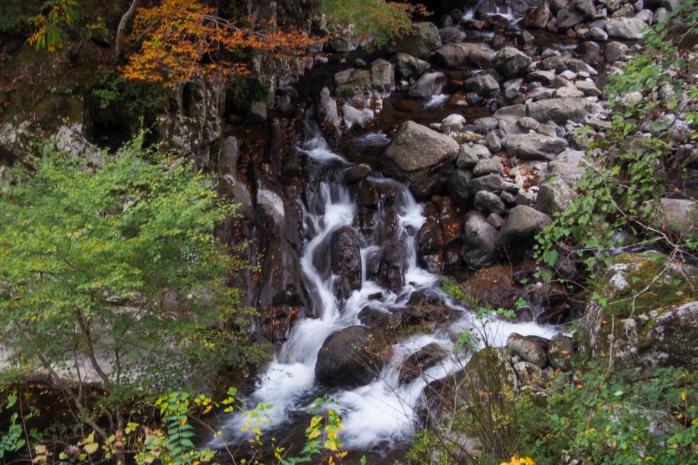
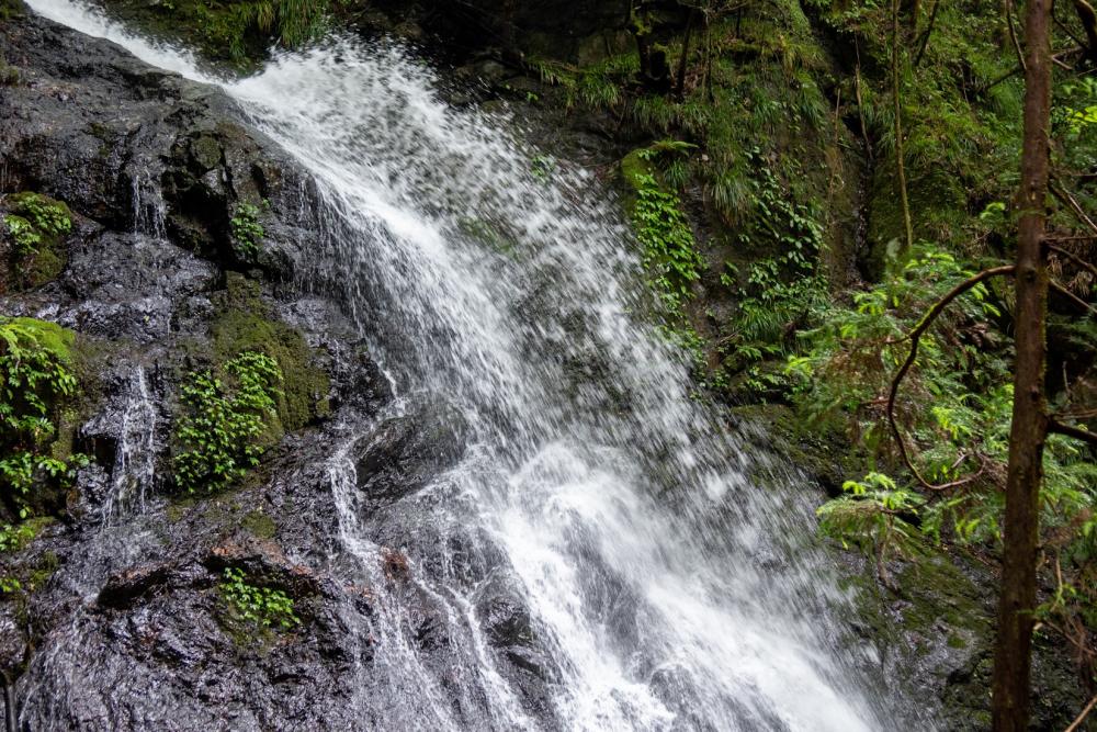
Getting back on the paved forest road and continuing upstream a little less than 1 km, we came to Todoroki-no-taki falls.
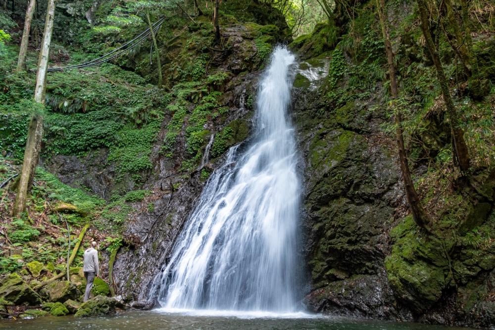
Created by water coming down from the headwaters of the Sugijidanigawa river, the 18m high waterfalls was a soothing quiet place in the woods. We could easily approach the fall itself by walking around the big perfectly clear waterfall basin
Among waterfall enthusiasts, Todoroki-no-taki falls are particularly interesting for its so-called "hyonguri" splash.
What is "hyonguri" splash? The word describes the way the water jumps down the cliffs in an arched shape. At Todoroki-no-taki falls, the “hyonguri” splash is usually at the top of the waterfall and it is most clearly visible by looking at the fall from the left side.
Mt. Yamainudake, Shikoku’s most popular awe-inspiring moss forests
Mt. Yamainudake is no doubt the most popular landmark of Kamikatsu. Its huge moss forests have become one of the best tourist destinations in Tokushima and are getting more well known throughout Japan.
Halfway up the mountain from the trailhead, a vast area is covered with lush green sphagnum mosses.
The trailhead can be reached only through a tranquil mountain village via winding steep narrow roads barely wide enough for only a single car to pass. In order to protect the quiet life of the villagers who have lived here for generations, the parking space for hikers to Mt. Yamainudake is two kilometers down the road from the trailhead.
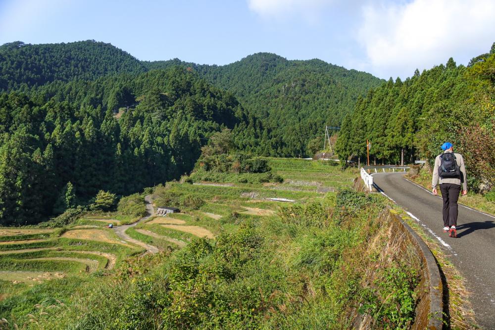
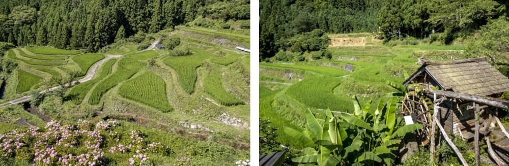
On the way to the trailhead, we passed the Kashihara terraced rice paddies.
To use as much of the flat land on the mountain as possible, all the rice paddies has irregular curved outlines.
During the rice planting season in late spring, the water filled in the paddies reflects the blue sky and stars at night like mirrors. In autumn, the golden tassels of rice cover the paddies and thick lines of burning red Higanbana (cluster amaryllis) border them.
Every season, the terraced rice paddies attract a lot of visitors and photographers.
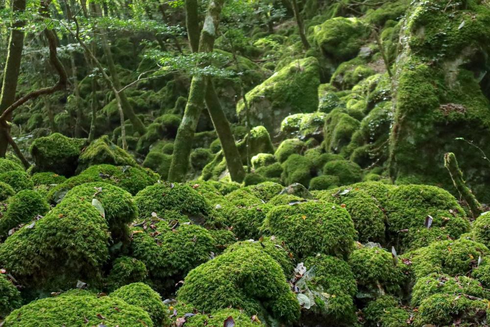
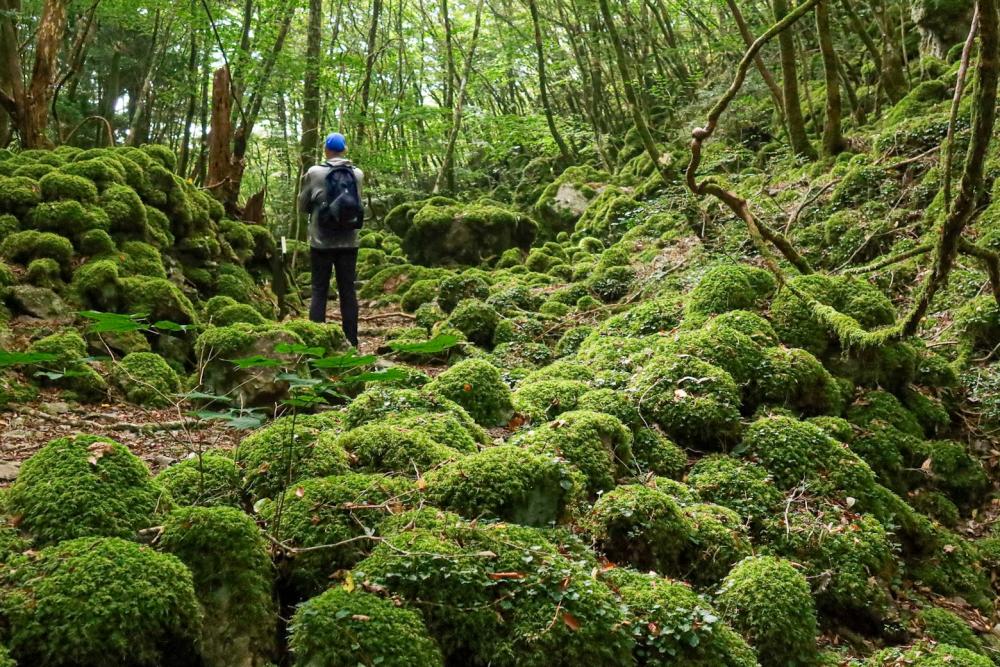
The moss forest of Mt. Yamainudake is about 1 km up from the trailhead.
Following the trail signs, we slowly made our ascent on the easy-to-walk trail through Japanese cedar forests. Suddenly we came out of the cedar trees to enter the area covered with uncountable numbers of small round rocks covered with green mosses.
Every step the way, the mosses became thinker as if they tried to fill every tiny gap between the rocks.
We were standing in a breathtakingly stunning fantasy world of shining green mosses and wild trees.
The peak of Mt. Yamainudake’s used to be higher than it is today. It is said the name of the mountain came from the original shape of the peak looking like a barking wild dog.
In 1701, heavy downpours caused a massive landslide at the top of the mountain. The debris of rocks stopped at the hillside and was completely covered with mosses over the years creating the moss forests today.
The piling of the huge rocks made various crevices and caves, in which the mountain ascetic practitioners placed small stone Buddhas representing the main deities of the Shikoku 88 pilgrimage temples to create a unique mini version of the Shikoku 88 pilgrimage in the moss forests.
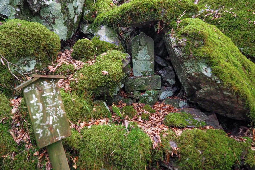

Along the route of the mini Shikoku 88, we often had to climb up and down rocks and go through the narrow crevice tunnels like a natural obstacle course. Fun but physically challenging, we needed to watch our steps not to slip.
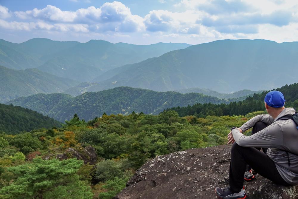
There is an especially huge rock called Miharashi-iwa (overlook rock) whose flat wide top sticks out of the trees could accommodate a big group of people. We got an amazing view of mountains over the sea of trees from here.
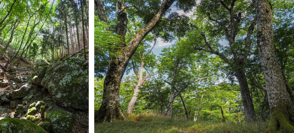
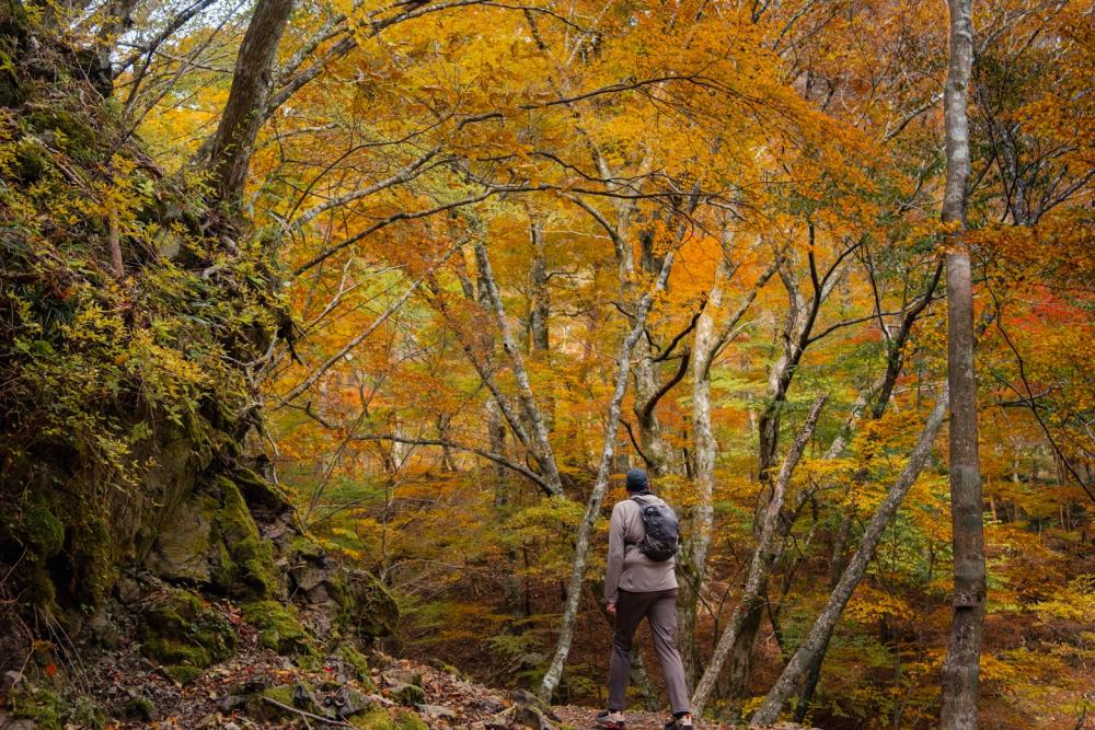
Mt. Takamaru, the highest mountain protected in the pristine beech forests
Last but not least, we cannot miss the highest mountain in Kamikatsu, Mt. Takamaru.
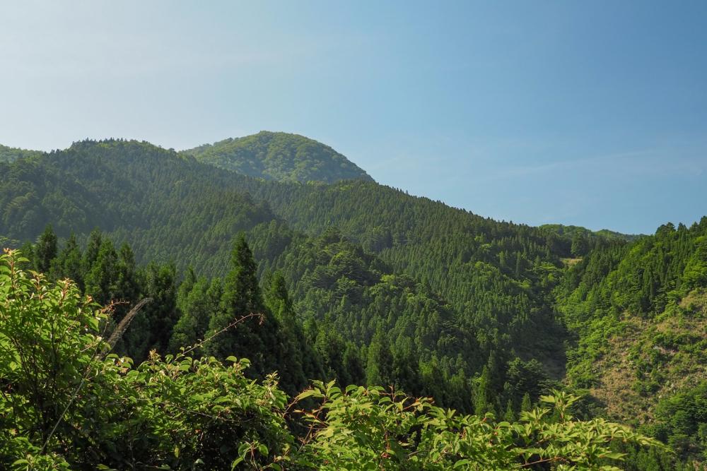
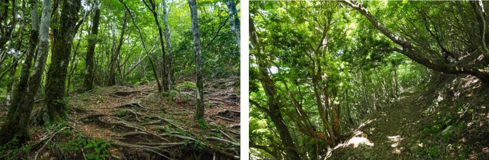
Located on the western edge of the town, the mountain is covered with pristine beech forests which have been carefully conserved as the precious water source for the villagers living at the foot of the mountain.
Although the height of Mt. Takamaru is 1439 m, cars can easily access the big trailhead parking area at the seventh station, which is at around 1000 m. Hikers without special physical fitness can enjoy walking around the mountain.
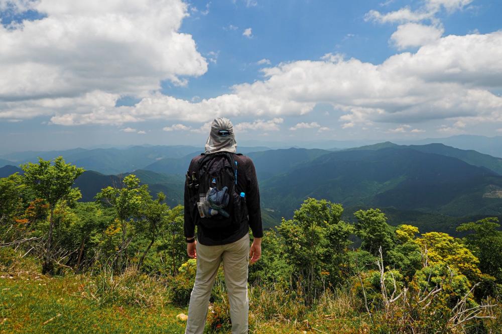
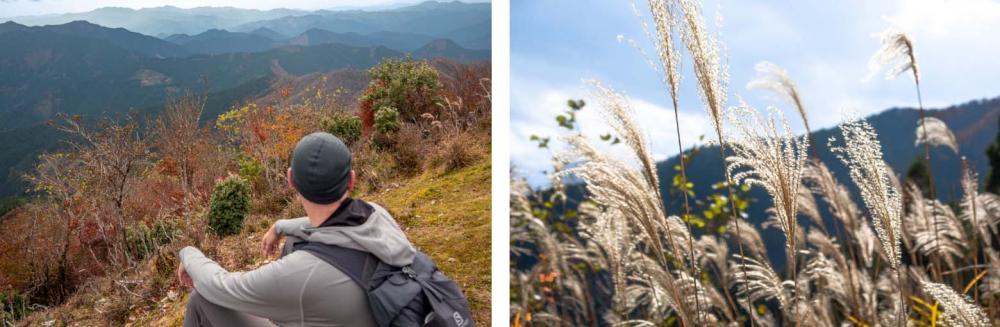
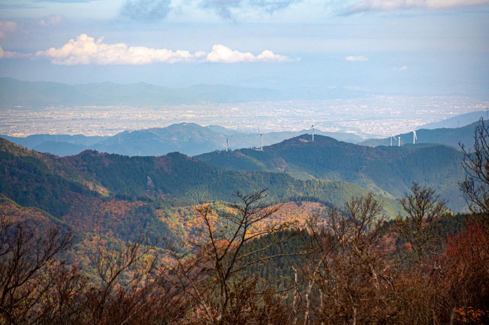
The view from the top provides a perfect 360-degree panorama.
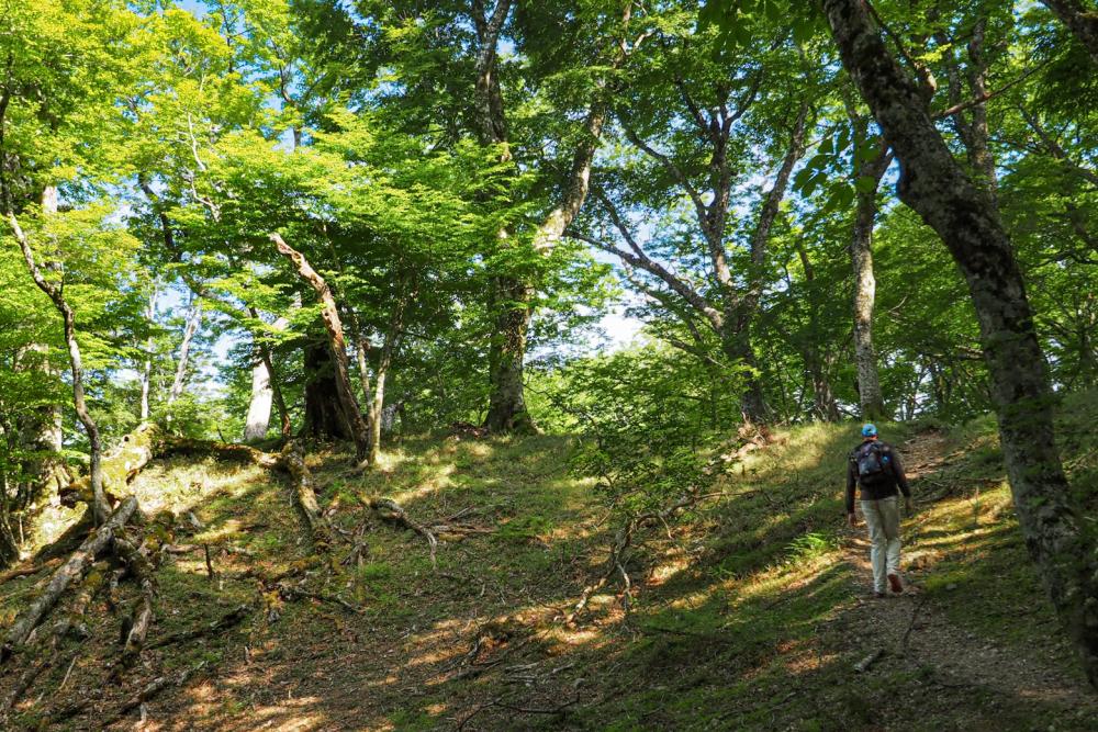
A circular trail around the mountain is well-maintained by the local fans of Mt. Takamaru.
From the peak, Mt. Kumoso, the highest mountain in Kamiyama is to the north.
The 8-km traverse of the ridgeline between the two highest mountains in each town is very popular for more experienced hikers who want a challenge.
This time, we were here to relax so we took it easy and had long lunch break at the peak.
The weather was perfect and the air was so clear that we could see the Pacific Ocean to the south, the Tsurugi cordillera mountain range to the west, and the towns and cities along the Yoshinogawa river to the northeast, as well as the Naruto straits bridge and Awaji Island.
Though Mt. Takamaru attracts hikers throughout the year, autumn is particularly popular, which usually begins earlier than lower areas.
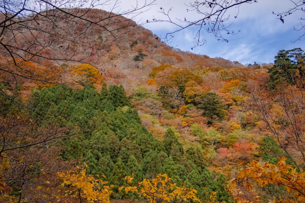

Most of the mountains in Kamikatsu are covered with artificially planted evergreen Japanese cedar trees for forestry, while Mt. Takamaru’s pristine beech forests change their colors in fall,dressing up the mountain in a gorgeous array of red, orange, and pink brocades.
At the same time, the cooler air gets clearer offering better visibility from the mountain peak. Around the parking area at the trailhead, fields of high white-golden pampas grass sway in the wind.
●Download “HIKE! TOKUSHIMA” booklet
https://www.east-tokushima.jp/brochure/